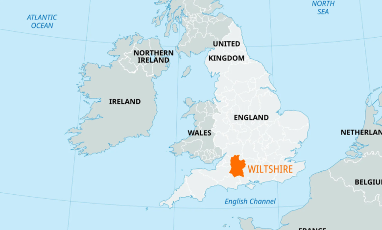
Planning a journey through one of England’s most historic counties becomes much easier with a detailed Wiltshire England map. Whether you are travelling to famous landmarks, researching local geography, or exploring charming market towns, a reliable map helps you understand the county’s layout. Wiltshire is known for its rolling countryside, ancient monuments, picturesque villages, and excellent transport links, making it a favourite destination for visitors throughout the year.
A well-designed Wiltshire England map provides far more than directions. It highlights major roads, towns, rivers, historic attractions, and surrounding counties, allowing travellers to plan efficient routes and discover hidden gems. From the world-famous Stonehenge to the medieval streets of Salisbury, every corner of Wiltshire offers something unique. This guide explains everything you need to know about the county’s geography, towns, and important locations.
Wiltshire England Map: Where Is Wiltshire Located?
Wiltshire is a ceremonial county situated in South West England, surrounded by several well-known counties including Gloucestershire, Oxfordshire, Berkshire, Hampshire, Dorset, and Somerset. Its central location makes it an excellent destination for travellers exploring southern England. A detailed Wiltshire England map clearly shows these neighbouring counties, helping visitors understand how the region connects with the rest of the country.
The county lies approximately 90 miles west of London, making it an ideal destination for day trips and weekend breaks. Thanks to excellent motorway and railway connections, reaching Wiltshire is convenient from many major UK cities. Looking at a Wiltshire England map location also helps visitors identify nearby attractions, scenic countryside, and transport routes before starting their journey.
Understanding a Wiltshire England Map
A modern county map contains much more than town names and road numbers. It displays administrative boundaries, rivers, forests, villages, railway stations, and protected landscapes. Reading these features helps visitors navigate confidently whether travelling by car, train, bicycle, or on foot. Every section of the map provides useful information for planning an enjoyable visit throughout the county.
Major roads including the A303, A350, A36, and A4 are clearly marked on most maps, making travel between towns simple and efficient. Railway lines connecting Salisbury, Chippenham, Swindon, and Trowbridge are also easy to identify. A detailed Wiltshire England map helps travellers estimate distances, discover alternative routes, and locate nearby facilities during their journey across the county.
Wiltshire England Map with Towns
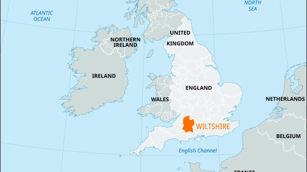
One of the most valuable features of a Wiltshire England map with towns is its clear display of the county’s main settlements. Salisbury, Trowbridge, Chippenham, Devizes, Marlborough, Melksham, Warminster, Calne, Corsham, and Amesbury each offer their own unique attractions. These towns are connected by an excellent network of roads, making it easy for visitors to explore multiple destinations in one trip.
Beyond the larger towns, Wiltshire is home to countless attractive villages surrounded by rolling hills and peaceful countryside. Places such as Lacock, Castle Combe, and Bradford-on-Avon attract thousands of visitors every year because of their historic architecture and welcoming atmosphere. Using a Wiltshire England map with towns allows travellers to discover these picturesque locations that are sometimes overlooked by standard travel guides.
Salisbury Wiltshire England Map
Salisbury is one of the county’s most famous cities and appears prominently on every Salisbury Wiltshire England map. Located in the southern part of the county, Salisbury is recognised for its magnificent cathedral, charming medieval streets, independent shops, and vibrant cultural scene. The city serves as a convenient base for exploring many of Wiltshire’s most popular attractions.
Roads including the A36 and A338 provide easy access to Salisbury from neighbouring counties, while regular rail services connect the city with London, Bristol, Southampton, and Exeter. A Salisbury Wiltshire England map helps visitors locate nearby attractions including Old Sarum, Wilton House, and several beautiful walking trails. Understanding the city’s layout ensures a more enjoyable and stress-free visit.
Stonehenge Wiltshire England Map
Stonehenge remains one of Britain’s most recognised prehistoric monuments and attracts millions of visitors from around the world. Every Stonehenge Wiltshire England map clearly identifies the monument near Amesbury, only a short drive from Salisbury. The site is easily accessible by road and forms one of the most important landmarks displayed on any county map.
Visitors often combine Stonehenge with nearby attractions including Old Sarum, Woodhenge, and the historic city of Salisbury. A detailed Stonehenge Wiltshire England map helps travellers organise their itinerary efficiently while identifying visitor facilities, parking areas, and surrounding roads. This makes exploring one of England’s greatest historical treasures both convenient and enjoyable.
Fisherton Anger Wiltshire England Map
Fisherton Anger is a historic area located close to the centre of Salisbury and is often identified on a detailed Fisherton Anger Wiltshire England map. Although relatively small, it has played an important role in the city’s development for centuries. Today, the area is known for its convenient location, independent businesses, and easy access to Salisbury’s railway station and shopping streets.
Visitors exploring Salisbury frequently pass through Fisherton Anger while travelling between the railway station and the historic city centre. A Fisherton Anger Wiltshire England map helps travellers identify nearby roads, public transport links, hotels, restaurants, and local attractions. Understanding this part of Salisbury allows visitors to move around the city with confidence while appreciating its historical significance.
Major Attractions Found on a Wiltshire England Map
A detailed Wiltshire England map highlights many of England’s most remarkable attractions. Stonehenge remains the county’s best-known landmark, but there are numerous other destinations worth exploring. Avebury Stone Circle, Salisbury Cathedral, Longleat House and Safari Park, Lacock Village, Caen Hill Locks, and the famous Wiltshire White Horses all appear on quality county maps, making travel planning much simpler.
The county offers a wonderful mix of history, nature, and family-friendly attractions. Visitors can enjoy scenic countryside walks, explore medieval towns, discover ancient monuments, or relax in beautiful gardens. Using a Wiltshire England map allows travellers to organise efficient routes between attractions while making time to visit lesser-known villages and picturesque landscapes that showcase the county’s unique character.
Roads, Transport and Getting Around Wiltshire
Wiltshire benefits from an excellent transport network that connects towns, villages, and tourist attractions throughout the county. Major roads such as the A303, A36, A350, and A4 provide straightforward driving routes, while nearby motorways improve access from London, Bristol, Southampton, and the Midlands. A reliable map helps motorists choose the most suitable route according to their destination.
Rail travel is equally convenient, with stations in Salisbury, Chippenham, Trowbridge, Westbury, and Melksham providing regular services to many parts of the United Kingdom. Local bus services also connect rural communities with larger towns, making public transport a practical option for visitors. Whether travelling by car or train, a county map remains an essential companion throughout the journey.
How to Use a Wiltshire England Map for Travel Planning
Careful planning can make any visit to Wiltshire more enjoyable, and a detailed county map is the perfect place to begin. Travellers can identify accommodation, tourist attractions, walking routes, nature reserves, and nearby towns before setting out. This helps reduce travel time and ensures that more attractions can be visited during a single trip across the county.
Families, walkers, photographers, and history enthusiasts all benefit from using a Wiltshire England map before exploring the region. The map helps visitors create personalised travel itineraries, locate picnic spots, and discover charming villages away from busy tourist areas. By planning ahead, visitors can enjoy a smoother, more rewarding experience while exploring everything Wiltshire has to offer.
Digital, Printable and Interactive Wiltshire Maps
Modern travellers have access to several different types of county maps depending on their needs. Digital maps provide live navigation and traffic updates, while printable maps remain useful for countryside walks where mobile signals may be limited. Tourist maps often highlight major attractions, visitor centres, and recommended driving routes across the county.
Interactive mapping services have transformed the way people explore Wiltshire by offering satellite imagery, route planning, and real-time navigation. Despite these technological advances, traditional printed maps continue to provide excellent reliability during outdoor adventures. Choosing the right type of map depends on your travel plans, but each option makes exploring Wiltshire easier and more enjoyable.
Conclusion
A detailed Wiltshire England map is an essential resource for anyone planning to visit or learn more about this fascinating county. From understanding county boundaries to locating historic towns and world-famous landmarks, a quality map helps travellers make informed decisions before and during their journey. It offers valuable insight into the county’s geography, transport links, and cultural heritage.
Whether you are visiting Salisbury, exploring Stonehenge, discovering Fisherton Anger, or travelling through the beautiful countryside, a reliable map ensures every journey runs smoothly. Wiltshire combines history, natural beauty, and welcoming communities, making it one of England’s most rewarding destinations. With careful planning and the right map, every visit can become an unforgettable experience.
Frequently Asked Questions
What is a Wiltshire England map used for?
A Wiltshire England map helps visitors locate towns, villages, attractions, major roads, railway stations, and county boundaries. It is useful for planning holidays, road trips, sightseeing, and understanding the geography of South West England.
Where is Wiltshire located in England?
Wiltshire is situated in South West England. It borders Gloucestershire, Oxfordshire, Berkshire, Hampshire, Dorset, and Somerset, making it an easily accessible county from many parts of southern Britain.
Which towns appear on a Wiltshire England map with towns?
Most detailed maps include Salisbury, Trowbridge, Chippenham, Devizes, Marlborough, Melksham, Warminster, Corsham, Calne, Amesbury, and many smaller villages throughout the county.
Where is Stonehenge located on the Wiltshire map?
Stonehenge is located near Amesbury in southern Wiltshire, approximately eight miles north of Salisbury. It is clearly marked on nearly every tourist and road map of the county.
Why is Salisbury important on a Wiltshire map?
Salisbury is one of Wiltshire’s most historic cities and serves as a gateway to many popular attractions. It is famous for Salisbury Cathedral, Old Sarum, excellent transport links, and its close proximity to Stonehenge.
Can I use a digital Wiltshire England map while travelling?
Yes. Digital maps provide live navigation, route planning, traffic updates, and nearby points of interest. Many travellers also carry a printed map as a reliable backup when exploring rural areas with limited mobile coverage.
Also Read: Hartford England

